Prompted by a comment by Tom in the June open thread, the time has evidently come to open the 2023 Northwest Passage passage thread. First of all let’s get our bearings with the help of this map of the area:
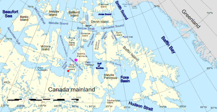
and another map detailing the routes through Canadian Arctic Archipelago that have previously been successfully traversed:

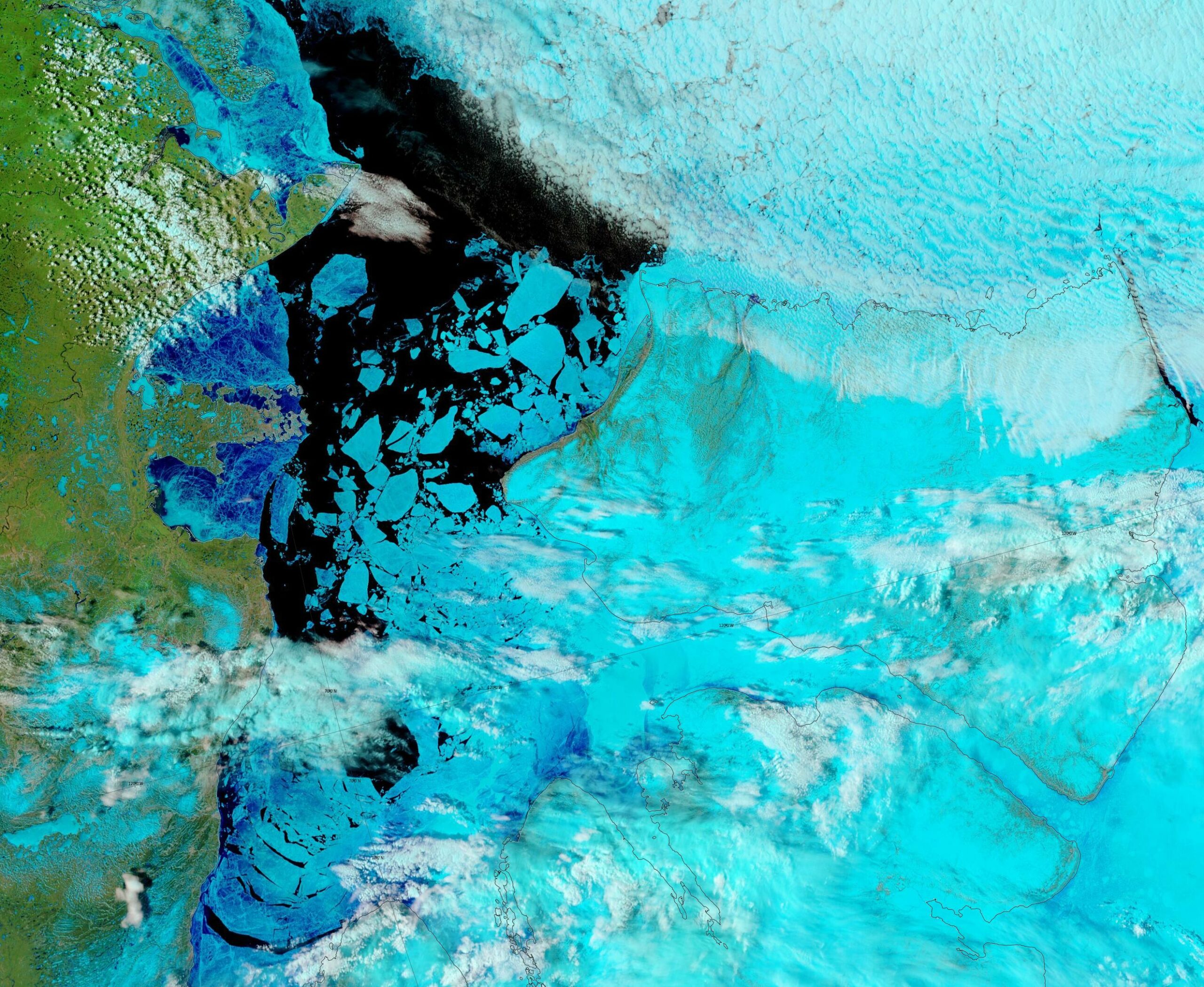
As our starter for ten for 2023, there is already plenty of open water in the Amundsen Gulf, together with plenty of melt ponding on the remaining fast ice in Franklin and Darnley Bays:
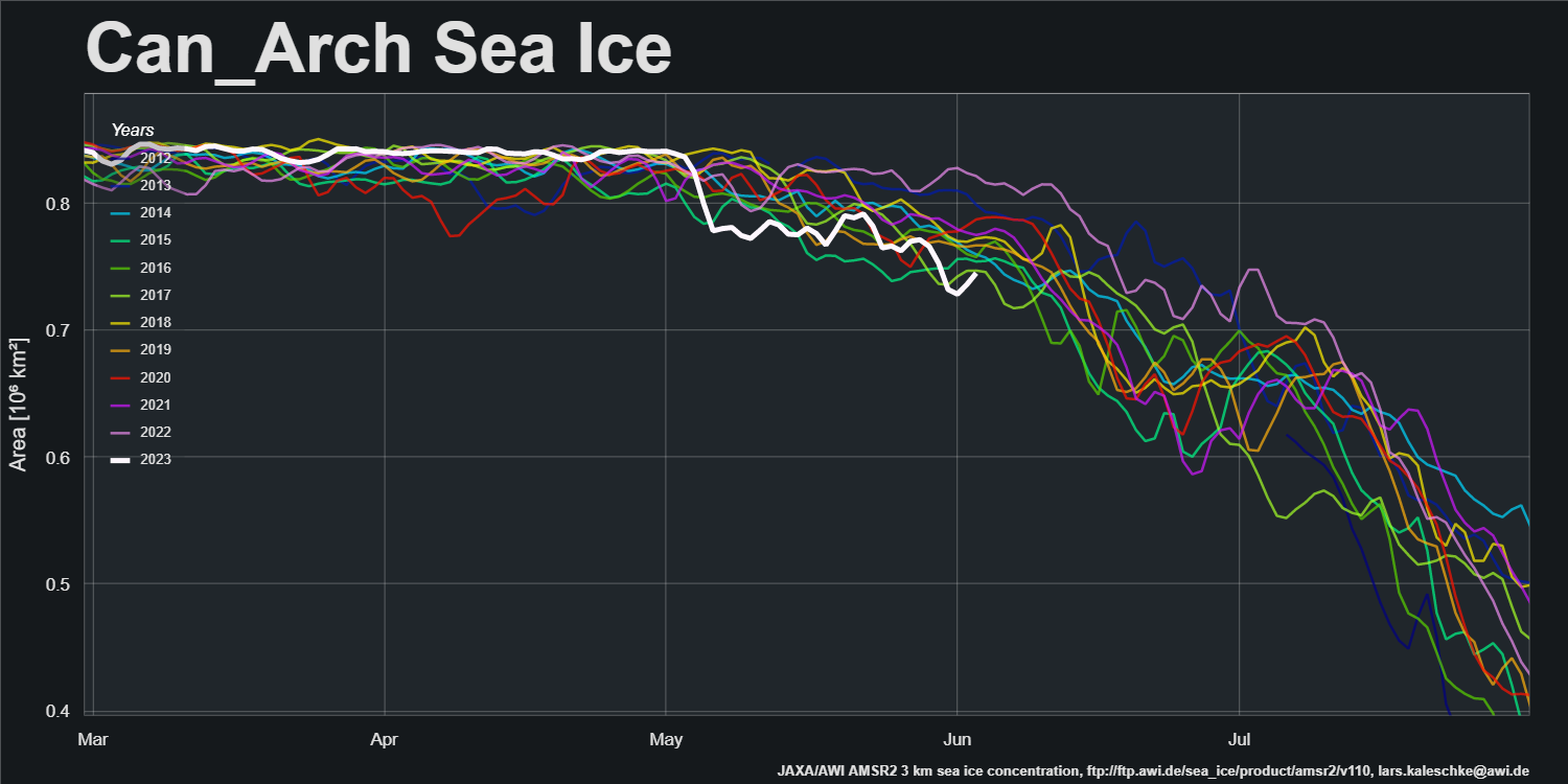
That is reflected in the current Canadian Arctic Archipelago sea ice area graph:
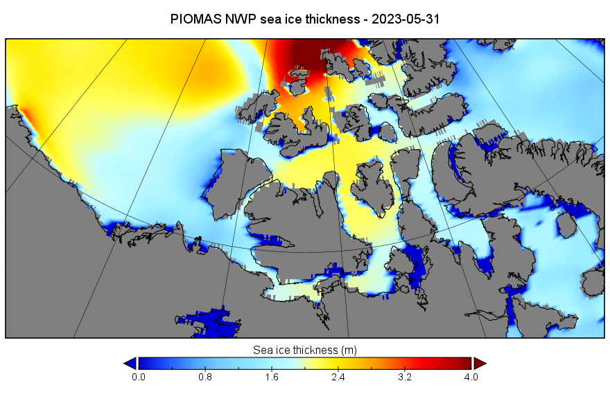
Let’s also take a look at the third dimension. Here’s the PIOMAS gridded thickness map for May 31st:
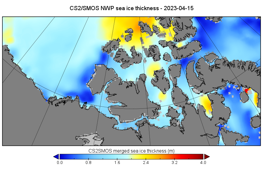
Here too is the last CryoSat-2/SMOS merged thickness map of the winter, from April 15th:
To get a better feel for what might happen during the coming summer season let’s also take a look at the Canadian Ice Service‘s “stage of development” charts. Here’s the most recent one for the “Western Arctic”, from May 29th:
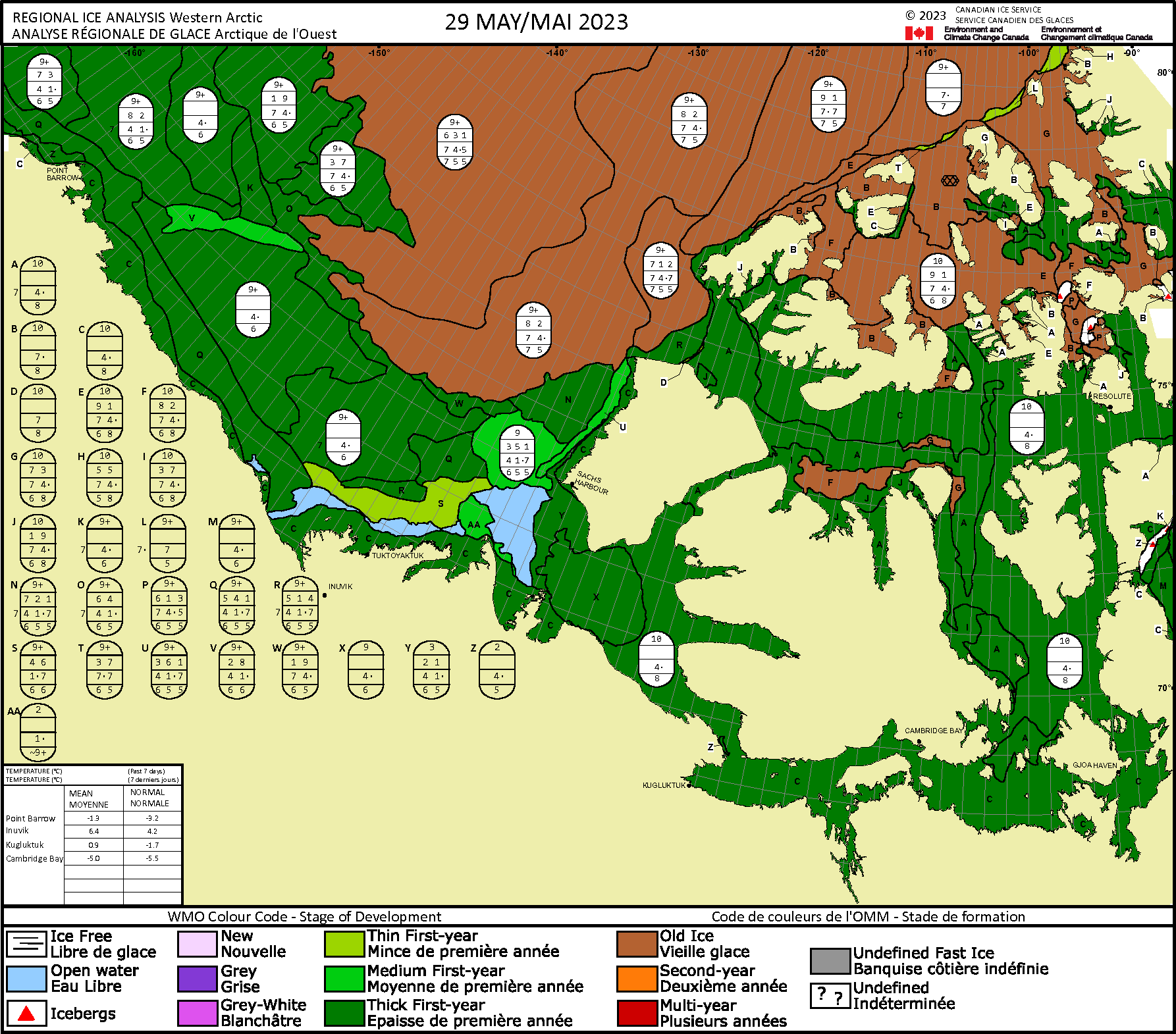
Note that none of the assorted routes through the North West Passage are currently blocked by old ice. Not even Route 1 via McClure Strait!
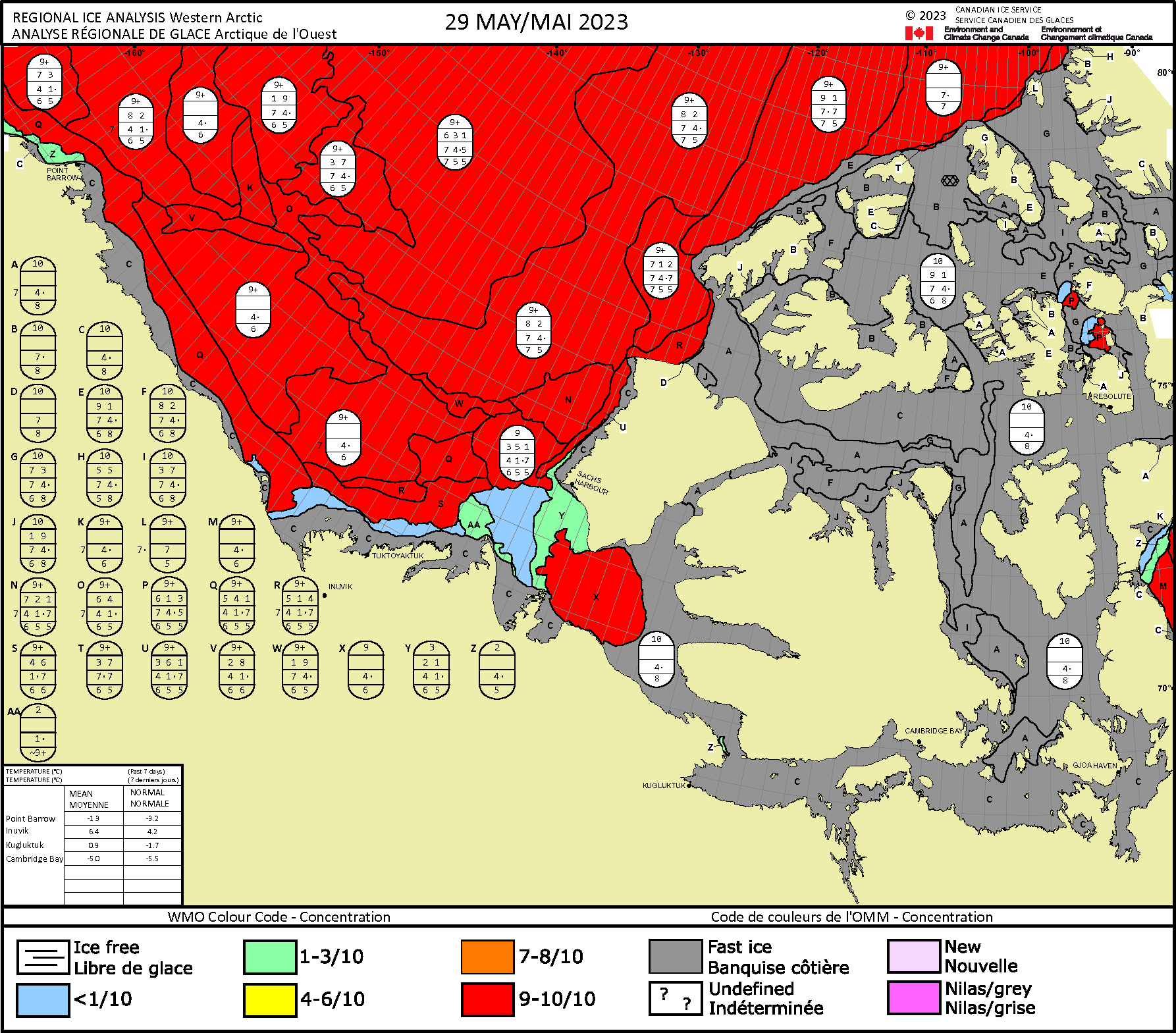
Finally, for the moment at least, here too is the CIS’s sea ice concentration chart:
To be continued…